
Imputation of MODIS AOD
Deep Learning for Satellite Aerosol Data Reconstruction
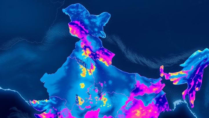
A research project focused on reconstructing missing Aerosol Optical Depth (AOD) observations over the Indian region using satellite-derived MAIAC data and deep learning. The proposed approach combines an autoencoder-based deep residual network with meteorological variables, MERRA-2 GMI atmospheric data, elevation, and ground-based AERONET observations to investigate the imputation of spatial and temporal gaps in satellite AOD datasets.
Overview
This project proposes a way to fill the gaps in satellite aerosol data over India with a deep-learning model to be trained on 1 km MAIAC AOD, so air-quality and climate work can have a continuous aerosol record instead of a patchy one. It is a proposed research design: the model has not yet been trained or tested, and the results section lists expected outcomes only.
Team | Kumar Prakhar, Irshad Alam, Mandeep Kumar, Pradeep Kumar (Department of Data Sciences, Rungta College of Engineering & Technology, Bhilai) |
Guide | Dr. Padmavati Shrivastava, HOD (AI/AIML), Rungta College of Engineering & Technology |
Mentor | Dr. Manu Mehta, Scientist SF, IIRS, ISRO |
Role | Team Lead |
Timeline | Feb, 2025 - Nov, 2025 |
Tech stack | MAIAC and MODIS Terra/Aqua AOD, AERONET v3 Level 2, MERRA-2 GMI, meteorology, deep residual autoencoder, bagging ensemble |
Links |
Aerosol Optical Depth (AOD) measures how much light aerosols in the atmosphere block, and it is a core input for air-quality monitoring and climate modeling. MODIS on NASA's Terra and Aqua satellites provides AOD globally, but cloud cover and sensor limits leave large gaps. We propose an imputation approach for the Indian region that uses the higher-resolution MAIAC product as its base.
The Problem
MODIS AOD has spatial and temporal holes exactly where and when people need it, because clouds and sensor limits block the retrieval. Anyone using the data downstream inherits those holes.
Three groups feel the gap most:
- Air quality: pollution monitoring needs continuous aerosol coverage, not only clear-sky days.
- Climate modeling: predictions are only as good as the aerosol record that feeds them.
- Environmental policy: regulations depend on accurate, complete assessments.
Existing imputation methods also fall short in ways that matter for India:
- They struggle with complex aerosol mixtures.
- They perform poorly in cloudy regions.
- They are rarely validated against ground observations.
- They generalize badly across regions and conditions, are hard to interpret, and show seasonal bias.
- The opportunity is an imputation technique designed for the Indian region, using a finer-resolution product and checked against ground truth.
Goals & Constraints
Success would mean a continuous, accurate AOD dataset for India that holds up against independent ground measurements.
Goals
1. Algorithm development: build robust imputation algorithms on MAIAC data over the Indian region.
2. Performance evaluation: evaluate the algorithms against AERONET observations.
3. Quantify improvement: show a measurable gain in AOD data coverage.
Constraints and trade-offs that shaped the design
- Gaps are structural. Clouds and sensor limits cause the missing data, so the proposed model has to infer values from other signals rather than from the AOD field itself.
- Resolution vs. input availability. MAIAC is 1 km, but supporting inputs such as MERRA-2 are far coarser and are planned to be downscaled to match.
- Two overpass times. Terra (about 10:30 AM) and Aqua (about 1:30 PM) see the atmosphere at different moments, so their values need to be fused carefully.
- Ground truth is sparse. AERONET stations are few, so they suit bias correction and validation better than full-coverage training.
- Regional focus. Methods tuned elsewhere do not transfer cleanly, so the approach is designed for India.
Approach & Key Decisions
We propose to impute AOD with a deep residual autoencoder trained on MAIAC data, supported by meteorology, downscaled MERRA-2 and elevation, then corrected against AERONET. Each design choice is meant to answer a specific weakness in earlier methods.
Decision | Why |
|---|---|
Use MAIAC AOD as the base product | It offers 1 km resolution against MODIS's 10 km, with better cloud screening and atmospheric correction, so imputed values should be more precise and cover more area. |
Deep residual autoencoder | An encoder-decoder compresses the inputs into a 16-node latent representation, and residual connections carry encoder detail straight to the decoder so fine structure is less likely to be lost. |
Weekly and monthly AOD averages as inputs | They give the model temporal context, so it can estimate a missing day from surrounding behavior. |
Meteorology, elevation and coordinates as predictors | Weather and terrain strongly shape aerosol patterns, which helps in places where AOD itself is missing. |
MERRA-2 GMI, downscaled | It adds modeled aerosol and chemistry information that exists even under cloud, but only after being brought to a finer grid. |
Full and non-full models, then bagging | Training separate models and combining them as an ensemble should lower variance and make predictions steadier. |
Hyperparameter tuning with cross-validation | It is meant to guard against overfitting before anything is trusted. |
Bias correction with AERONET | Independent ground observations would check and adjust the model's final output, addressing the validation gap noted in earlier work. |
The approach follows the line of work in Li et al. (2020) on spatiotemporal imputation of MAIAC AOD with deep learning and downscaling, to be adapted to the Indian region.
Architecture & System Design
The proposed workflow cleans and averages raw MAIAC imagery, combines it with meteorology and downscaled MERRA-2 data, passes it through a residual autoencoder, then ensembles, tunes and bias-corrects the output against AERONET.

- Read the top band left to right as data preparation, then follow the arrow down the right side and back left through ensembling, tuning and AERONET correction to the final model.
- Proposed preprocessing pipeline
1. Reproject the raw MODIS/MAIAC images to UTM.
- 2. Filter outliers and noise.
- 3. Apply QA flags to remove contaminated pixels.
- 4. Compute the per-pixel daily average.
- 5. Fuse Aqua and Terra values.
- 6. Mosaic and crop the MAIAC tiles.
- 7. Calculate the weekly AOD average, and the monthly average from the same mosaics.
Datasets
Dataset | Source | What it provides |
|---|---|---|
MAIAC AOD | NASA EarthData | AOD at 1 km from MODIS Terra and Aqua, which cross the equator at about 10:30 AM and 1:30 PM local time |
AERONET AOD | NASA GSFC | Level 2, quality-assured, version 3 ground observations used for validation and bias correction |
Meteorology | NASA EarthData | Daily surface meteorological variables at about 4 km (1/24th degree) |
MERRA-2 GMI Replay Simulation | NASA GSFC | Global reanalysis that assimilates aerosol remote sensing, emissions and meteorology, and adds chemistry, land, ice and ocean biogeochemistry |
Elevation and coordinates | Google Maps API | 30 m elevation averaged over each 1 km MAIAC grid cell, used as a model variable |
Technical Deep Dive
The proposed core model is an autoencoder-based deep residual network: it compresses 15 input nodes down to a 16-node latent representation, expands them back, and uses dashed residual connections to hand encoder features directly to the matching decoder layers.
Residual connections carry encoder detail straight to the decoder

Numbers are node counts and box height is schematic. Every layer output is activated, then batch-normalized.
How the layers are set up
- Encoder: 15 input nodes, then hidden layers of 128, 64 and 32 nodes.
- Latent space: a 16-node bottleneck.
- Decoder: hidden layers of 32, 64 and 128 nodes, then a 15-node layer.
- Output layer: 16 output nodes.
- Per-layer treatment: the output of every layer is passed through an activation and then batch normalization.
- Why residual connections. A plain autoencoder forces everything through the narrow bottleneck. The residual connections give each decoder layer a direct view of its encoder counterpart, so fine detail can bypass the 16-node latent layer. Batch normalization at every layer is intended to keep training stable across a network this deep.
Challenges & Trade-offs
The model has not been trained yet, so these are the challenges and trade-offs the design anticipates, mostly from mismatched data rather than from the network itself.
- Raw satellite data is noisy. Tiles will need reprojection to UTM, outlier filtering and QA-flag screening before any averaging, and each of those steps removes pixels from an already gappy record.
- Scales do not match. MERRA-2 is far coarser than the 1 km MAIAC grid, so it must be downscaled before it can be a model input, which adds a layer of approximation.
- Two satellites, two overpass times. Fusing Terra and Aqua gains coverage but mixes observations taken about three hours apart.
- Complexity vs. interpretability. A deep model is expected to handle complex aerosol mixtures better than simpler methods, but it is harder to explain, which remains a research gap.
- Single model vs. ensemble. Bagging full and non-full models should improve stability at the cost of extra training and tuning time.
- Seasonal and regional bias. Monsoon cloud and regional aerosol mixes can skew a model, which is why validation against AERONET is part of the plan.
Results & Impact
The project's expected outcome is a continuous, accurate AOD dataset for the Indian region, validated against AERONET. No model has been trained or tested yet, so this section lists expected outcomes only, and the table below shows the metrics to report once results exist.

Expected outcomes
- Dataset: gap-free 1 km AOD that supports air-quality and climate analysis.
- Monitoring: more reliable, continuous environmental monitoring that informs decisions.
- Publication: peer-reviewed publications from the method and findings.
Reflection & Next Steps
The proposal rests on the view that good imputation depends as much on data preparation and validation as on the model. Cloud masks, QA flags, scale matching and ground-truth checks each decide whether the final dataset can be trusted.
What remains open
- Interpretability: explaining why the model fills a gap with a given value.
- Generalizability: testing across seasons, regions and aerosol conditions beyond the training set.
- Seasonal bias: checking behavior in monsoon and winter haze periods separately.
What to build next
- Report full validation statistics against AERONET by season and region.
- Add explainability tools, such as feature-importance analysis, to show which inputs drive each imputed value.
- Use the imputed AOD as input for daily PM2.5 estimation, as the cited literature does.
- Write up the method and results for peer-reviewed publication.
References & Resources
Supporting research
- Li, L., Franklin, M., Girguis, M., Lurmann, F., Wu, J., Pavlovic, N., et al. (2020). Spatiotemporal imputation of MAIAC AOD using deep learning with downscaling. Remote Sensing of Environment, 237, 111584.
- Li, L. (2020). A robust deep learning approach for spatiotemporal estimation of satellite AOD and PM2.5. Remote Sensing, 12(2), 264.
- Chen, Z. Y., Jin, J. Q., Zhang, R., Zhang, T. H., Chen, J. J., Yang, J., et al. (2020). Comparison of different missing-imputation methods for MAIAC AOD in estimating daily PM2.5 levels. Remote Sensing, 12(18), 3008.
Data sources
- NASA LAADS DAAC (MODIS / MAIAC)
- MODIS Version 6 MAIAC data products release
- AERONET, NASA GSFC
- gridMET meteorological data, Climatology Lab
Project links: GitHub